Broadway: Room For a Bicycle Lane
If Trevino gets his way, there will be no bicycle lanes down Broadway. From what I can gather from the Rivard Report about the meeting on the design of the lower half of Broadway, Trevino and the engineers at San Antonio Transportation And Capital Improvements (TCI) will find excuse after excuse not to put in a protected bicycle lane just like a petulant child refusing to take a bath. After putting a few clues together, I can tell you right now that there’s room for a 10ft protected bicycle lane and all it took was removing the parking lane and reducing the drive lanes from 12ft, to 11ft.

I’m going to be focusing on this images above (Image 4-1) as the main cross section that TCI oh so conveniently left the measurementsout the of the available right of way. Here they show a sidewalk, a section for the trees, another for parking, then the three lanes of traffic. According to them in previous news stories from the Rivard Report, this section of Broadway is 78ft wide. (Image 4-2)

The Image above, (Image 4-2) is what I came up with shortly learning about the available right of way. In this image looking north, I found room for a 12ft protected bicycle lane and at the time, I took into considerations of the annual Fiesta Parades that go down Broadway every year and that’s why you see a removable planter. I also wanted to show what bus would look like, so since streetmix don’t allow buses on ‘drive lanes,’ I used a ‘bus lane’ instead to illustrate that particular drive lane.

Image 4-3 
Image 4-4
Another clue comes from a recent tweet from TCI which states:
“Just FYI: our Complete Streets plans require us to incorporate trees
(native), traffic calming measures and LID (low impact development)
features to help create a better pedestrian experience.” Now if you look
at all the design proposals, it begins to make sense. Each one has
trees, each seems to make the place nice for people to walk around.
Now
that picture on the top (Image 4-1) and that one of the sidewalk now
begins to all make sense. Trevino’s Design measurements in a nutshell is
this…
*Sidewalks – 7ft
*Planting area – 5ft
*Parking/Rideshare Loading area – 9ft
*DRIVE LANES – 12ft.

This is why you see no measurements posted on the original display (Image 4-1) so they can’t be called out for having dangerous wide drive lanes. As a rule, wider the lane, the faster the car, the opposite of Vision Zero. For the city to really adhere to the principles of Vision Zero, they’re going to need narrow the lanes of traffic including those of boulevards like Broadway to 11ft wide. Ten foot wide drive lanes make perfect sense for streets that don’t have buses on them like N Main and Soladad, 11ft make sense for streets like San Pedro, S Flores, west and east Commerce and so on. So using the new measurements, I went about creating and came up with this.

Now my initial knee jerk reaction was, how incompetent do you need to be for a truck driver to design a boulavard that the citizens and the mayor want? It’s a valid question giving that I barely make $24,000 a year and just have some college under my belt. From the looks of all your previous projects which I talked about in the past, it is a valid question in this age of austerity. I have yet to hear why it’s so impossible to have 11ft drive lanes down our busiest stroads. There’s a reason why pedestrian deaths are up in the city and design plays a major role in creating a safe place. Any safety guru in some defensive driving class will tell you, the greater the speed, the greater the chance for car crashes. Even Texas Department of Public Safety in their Driver’s Manuel will tell you that the faster you go, the less area in front of the vehicle you are able to see and less time to react to problems that will occur.

Image 4-7 
Image 4-8
All in all, I found plenty of room for a 6ft bus stop island, (Image 4-7) trees either between the cars and the protected bike lane (Image 4-8) or the trees between the sidewalk and the protected bicycle lane.(Image 4-6) And before someone at TCI comes out and says that having a 1ft curb between the bicycle lane and on coming traffic is unacceptable, I will ask you to talk to the traffic engineers in Dallas, TX who worked on the protected bicycle lane on N Houston St right next to the American Airline Center. (Image 4-9) I am yet to write full blog post on my thoughts about visiting this protected bicycle lane back on June 1st, (Images 4-10, Images 4-11) but if they can do it in Dallas, what preventing us from doing this here?

Image 4-9 
Image 4-10 
Image 4-11
Avenue B / N Alamo
I understand how many
would rather be riding on Avenue B or N Alamo instead of Broadway. But
the reason why you should be for a protected bicycle lane on Broadway is
this; more people riding bicycles makes it safer for you riding your
bicycle and the simple fact, there’s no money available for a protected
bicycle lane down Avenue B and N Alamo.

Image 4-12 
Image 4-13
It was revealed several years ago that if you wanted safer places for
bicycles, you need to increase the number of people riding their
bicycles. You can advocate for helmets all day long, but studies have
shown that encourging people to wear bicycle helmets simply reduces the
number of people who ride bicycles. What encourages more people to ride
are safe places like protected bicycle lanes.
Another thing that was
mention in the Rivard Report that they don’t have the funding available
for the bicycle infrastructure down Avenue B or N Alamo. I believe that
the counter argument would be “so what.” Well during events especially
at the VFW, people attending these events will be looking for parking
and forcing those riding a bicycle into the middle of the street. That
leaves anyone on two wheels vulnerable to a hit and run or a collision
with a distracted driver desperate to find parking.
So this is what you must do:
1.
Contact the Mayor and thank him for his support for a protected bicycle
lane on Broadway. Share him this article and the pictures of the cross
sections that I’ve made. Contact info is at the end of this article.
2.
Contact Councilman Trevino and tell him that there’s no excuse for not
including a protected bicycle lane down Broadway. Contact info is at the
end of this article.
3. Contact Joe Doctor; share him this article
and the Image 4-6, Image 4-7, and Image 4-8 and remind him that he as a
duty to implement Vision Zero properly and ask him why a poor truck
driver found room for a 10ft protected bicycle lane when he was
incapable of doing so in the first place. Contact info is at the end of
this article. Also ask him how wide dangerous drive lanes improve
safety.
4. And Finally, spread the word of this article via social
media to the pages like the Rivard Report, Mayor Nirenberg, San Antonio
Transportation & Capital Improvements and Councilman Trevino. If on
Twitter, please use the following handles: @sanantoniotci,
@Ron_Nirenberg, @Trevino_D1, & @aer_451.
Contacts:
Mayor Ron Nirenberg: https://www.sanantonio.gov/mayor
Email: https://www.sanantonio.gov/Mayor/About/Contact?sendto=Mayor
Twitter: @Ron_Nirenberg
Facebook: https://www.facebook.com/nirenberg/
Councilman Roberto Trevino:
Email: https://www.sanantonio.gov/Council/d1/Email-Form
Twitter: @Trevino_D1
Facebook: https://m.facebook.com/RobertoTrevinoD1/
Joe Doctor, Project Director: Email: joe.doctor@sanantonio.gov
Recommended Media Sites:
Rivard Report:/ Email:
Facebook: https://m.facebook.com/RivardReport
Twitter: @RivardReport
News 4 WOAI: Email:
Facebook: https://m.facebook.com/news4sa.
Twitter: @News4SA.
KENS 5:
Email: https://www.kens5.com/mobile/contact-us
Facebook: https://m.facebook.com/kens5
Twitter: @KENS5
Sources:
Bus Stop Island: https://youtu.be/2Pvhkx0153k
@sanantoniotci Tweet: https://twitter.com/sanantoniotci/status/1144627961401872384?s=09.
Nirenberg, Treviño on Opposite Sides of Broadway BI Design Nears Completion: https://therivardreport.com/nirenberg-trevino-on-opposite-sides-of-broadway-bike-lane-debate-as-design-nears-completion/
Incomplete Street: Planners Put Vehicles First, People Second in Lower Broadway Plan: https://therivardreport.com/incomplete-street-planners-put-vehicles-first-people-second-in-lower-broadway-plan
The Health Impact of Mandatory Bicycle Helmet Laws: https://papers.ssrn.com/sol3/papers.cfm?abstract_id=1368064
Why Helmets Aren’t the Answer to Bike Safety — In One Chart https://usa.streetsblog.org/2016/06/02/why-helmets-arent-the-answer-to-bike-safety-in-one-chart/
Safety in Numbers: Biking Is Safest in Nations With the Most People on Bikes: https://usa.streetsblog.org/2015/02/27/safety-in-numbers-biking-is-safest-in-nations-with-the-most-people-on-bikes
Study: Bike lanes really do increase biking https://www.vox.com/2014/6/5/5782472/study-bike-lanes-really-do-increase-biking
Separated Bike Lanes Means Safer Streets, Study Says https://usa.streetsblog.org/2019/05/29/protect-yourself-separated-bike-lanes-means-safer-streets-study-says/
SA Doesn’t Make The List/There will be no Bike Lane on Broadway.: http://bikesanantonio.blogspot.com/2017/02/sa-doesnt-make-listthere-will-be-no.html
Pictures:
Image 4-1: A cross section of Broadway that was presented at the design meeting lacking the measurements of the right-of-way.
Image
4-2: My Broadway concept that I created back in 2017 showing how
there’s room for a protected bicycle lane. The top part of that picture
can be found here at: https://therivardreport.com/wp-content/uploads/2017/01/lower-broadway-3rd-road-diet.jpg, And the bottom of that picture can be found here at: http://streetmix.net/BikeSanAntonio/61/3rd-to-i-35
Image 4-3: TCI design drawing showing a cutout of the sides of Lower Broadway. Source: https://3snpdc2ba9m5uwuk62n8cs84-wpengine.netdna-ssl.com/wp-content/uploads/2019/06/lower-broadway-rendering.jpg
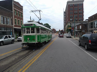
Image
4-4: The corner of N Main at W Travis (viewing east) which appears to
be similar to the TCI cutout of what’s design for Lower Broadway
Image
4-5: After doing some measurements of the widths in Image 4-4, this is
what the measurements that I concluded that Image 4-1 should have
included. Viewing North
Image 4-6: Using those same measurements this
is My concept of Lower Broadway showing how there’s plenty of room for a
10ft, two way protected bicycle lane. This one is showing the Sidewalk,
the tree and then the protected bicycle lane. Please remember that the
bus lane is a drive lane and streetsmix.net doesn’t allow me to put a
bus into a drive lane.
Image 4-7: Using those same measurements, I
show how a Bus stop Island can be incorporated into Lower Broadway
segment by removing the tree next to the sidwalk.
Image 4-8: Using
those same measurements, I show that that same space for a bus stop
Island can be also a planting area for the tree.
Image 4-9: A
Screenshot of Google Street View of N Houston St infront of the American
Airline Center, Dallas, TX showing a Protected Bicycle lane with just a
10in curb
Image 4-10: An Image of a cyclist riding in the protected
bicycle lane on N Houston St, Dallas, TX Photo taken on June 1, 2019
viewing west.
Image 4-11: An Image of a cyclist riding in the
protected bicycle lane on N Houston St, Dallas, TX Photo taken on June
1, 2019 viewing west.
Image 4-12: TCI photo showing the current condiction of Avenue B. Source: https://therivardreport.com/wp-content/uploads/2019/06/avenue-b-current.jpg
Image 4-13: TCI photo showing the concept of a protected bicycle lane with shade trees. Source: https://therivardreport.com/wp-content/uploads/2019/06/avenue-b-future.jpg

Comments
Post a Comment